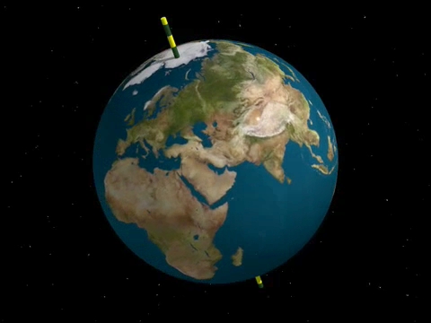
The Earth is, more or less, a sphere. So, if we are trying to explain a specific location, or an absolute location, how do we do that?
Let's pretend there are no states, no cities, no addresses to make locations easy to find. That shouldn't be too hard, there are several places in the world where that is true. So, how do we find a specific place? Well that's harder. Not only did it take centuries to figure out, but it's complicated to explain. Basically, though, it had to do with figuring out the sun's location in relation to time. It all had to do with angles and since angles are measured in degrees (and minutes and seconds, but we won't get into that, either), we will measure exact locations in degrees as well.
So, things would be so much easier if the Earth was flat. But it's not. But we are going to do our best to make it seem like it. We are going to draw lines on our sphere.
So, things would be so much easier if the Earth was flat. But it's not. But we are going to do our best to make it seem like it. We are going to draw lines on our sphere.
Will that help us locate a place on the Earth? Sure it would, but we have to make some rules:
First, those lines need names.
First, those lines need names.
What are we going to call the lines that go around our FAT earth like a belt?
 |
| Lines of Latitude |
Lines of LAT-itude. Latitude, Fatitude.
 |
| Lines of Longitude |
What are we going to call the LONG up and down lines?
Lines of LONG-itude. (They are also called Meridians)
So now we have some simple vocabulary, but that's not enough. We need to define zero. That will be the starting line. Or the place where the counting begins.
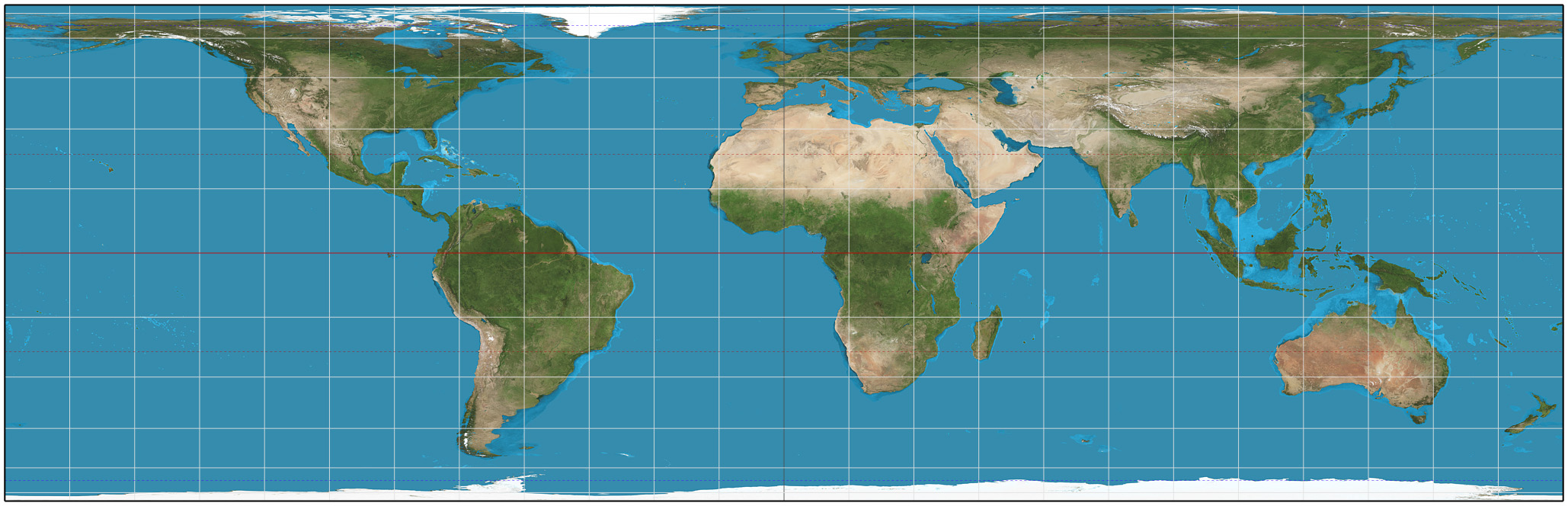
The line of latitude that goes around the center of the Earth is the equator. It is an equal distance from both the North and South Poles. It's 0°. It separates the Earth into two parts. Into halves. Into half-spheres. The correct term for that is hemispheres.

If you travel 10 ° North of that, the degrees of Latitude are labeled 10° N. If you travel 45° South of the Equator, you are at 45°S.
It sounds simple, right? You travel towards the North Pole (90° N) from the Equator, you are in the Northern Hemisphere and so are labeled North. Don't get confused. Lines of latitude RUN East and West, but are labeled for which hemisphere they are progressing towards a pole in. Lines of latitude are labeled North or South.
So which hemisphere is the US in? Are we closer to the North Pole or the South Pole?
So which hemisphere is the US in? Are we closer to the North Pole or the South Pole?
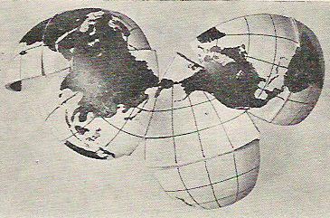
The Earth can also be divided into Eastern and Western Hemispheres. Hemi means half. So, you can only have two hemispheres at one time.

To divide the Earth into Eastern and Western Hemispheres, we have two important lines of longitude. Since longitudinal lines are also called meridians, that should give you a hint to what the main meridian is called. It's the Prime Meridian!
The Prime Meridian is labeled 0°. As you travel 5 ° West of the Prime Meridian, you are at 5° W. Make sense? So, if you travel 70 degrees East of the Prime Meridian, you are at 70° E. Meridians, or lines of longitude run North and South, but are labeled by which hemisphere they are moving away from the Prime Meridian in. Lines of Longitude are labeled either East or West.
 The crazy thing is that unlike the equator, it didn't matter in the least where the Prime Meridian was. The equator, by definition, is equidistant from the North and South Poles, but there is nothing to be half way between as far as longitude. But, at the time when it was decided exactly which meridian would be the Prime Meridian (which sounds like a Transformer), one country had a bigger voice than the rest of the others.
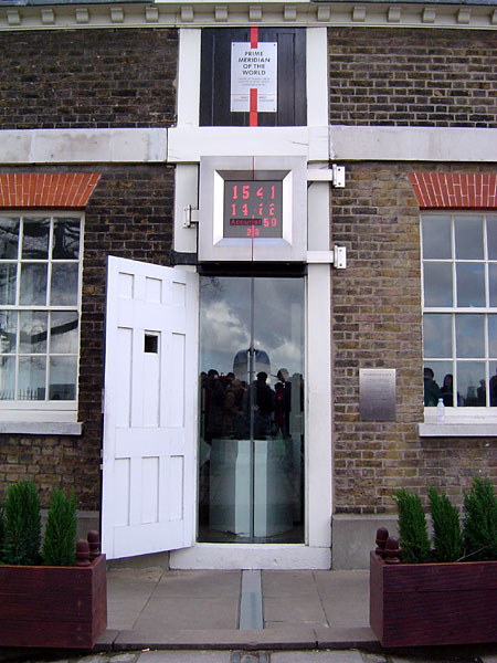
Which hemisphere is the US in? Are we West or East of the Prime Meridian?
 |
| Prime Meridian |
But the Prime Meridian is only one boundary of the Eastern and Western Hemispheres.
Look at the map. The Prime Meridian doesn't cut through the entire globe.
There is a second line that separates the Eastern and Western Hemispheres!
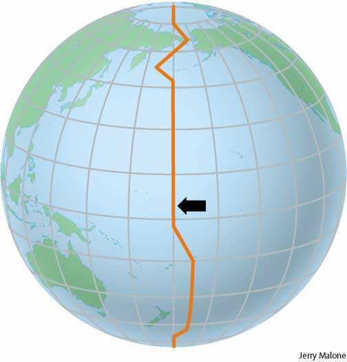 |
| International Date Line |
It's called the International Date Line!
The International Date Line is labeled 180°. That makes sense. There are 360° in a circle, and half of that is: 180°!
You might wonder: Why is it jagged? It's actually a really important time zone border. Not only would it be frustrating to have a country in two different time zones, but at this specific boundary, the date changes. So, while it could be Friday, August 7th, here, it's very possibly Saturday, August 8th in Japan. (I know that sounds crazy... just trust me... it's all about the rotation of the Earth)
So, now we have our lines of latitude (labeled N or S) and our lines of longitude (labeled E or W).
Let's look at the Earth in a way that we can see all the hemispheres at once.
 These are called quadrants.
Quadrants in the Northern Hemisphere are all labeled N for North.
Quadrants in the Southern Hemisphere are all labeled S for South. The same is true for quadrants in the Western and Eastern Hemispheres. They are labeled W and E.
If we divide the Earth into four pieces, then each piece is in two hemispheres at the same time.
So, let's say we want to find a location in North America. Which quadrant is that in?
If we were trying to find a location in North America using latitude and longitude, we now know that the coordinates are N and W. But let's be more specific.
 In 2005, the US suffered through one of the worst hurricane's in it's history. What is the absolute location of Hurricane Katrina?
New Orleans is 30° N of the equator and 90° W of the Prime Meridian. Do you see that on the map? So, our location is 30°N, 90°W.
 If you have a city, it seems useless to use latitude and longitude, but let's say that you discovered what must be an alien spaceship only partially visible under the sand in southwestern New Mexico. You are concerned that when you come back, it might be completely buried. So how will you find it again?
You are going to use latitude and longitude.
But what if our location also isn't nicely situated on one of the latitude or longitude lines? Well, we have to estimate.

Our spaceship siting is marked with the X. Let's do latitude first. It's between 30° and 40° N of the equator. Do you see that? Is it half way in between? If that were so, it would be 35°N. Be careful here. Do not confuse the northern border of New Mexico for a line of latitude. Do you see that it seems a little closer to 30° than halfway? It looks like it's at about 34°N. (Remember: North because we are moving towards the North Pole from the Equator.)
What about our longitude? It's between 100°W and 110°W of the Prime Meridian. (That's hard to tell on this map, but if a line isn't labeled, look at some other labeled lines and see by what number the cartographers were counting. Sometimes it's 5°, 10°, 15°... just make sure you look and don't guess!)
Is the X closer to 100° or 110°? It looks closer to 110°. Is it about halfway? Not really. Let's call that 107° W. Be careful with longitude. I have two suggestions:
Definitions:
Let's look at the Earth in a way that we can see all the hemispheres at once.

Quadrants in the Northern Hemisphere are all labeled N for North.
Quadrants in the Southern Hemisphere are all labeled S for South. The same is true for quadrants in the Western and Eastern Hemispheres. They are labeled W and E.
If we divide the Earth into four pieces, then each piece is in two hemispheres at the same time.
So, let's say we want to find a location in North America. Which quadrant is that in?
If we were trying to find a location in North America using latitude and longitude, we now know that the coordinates are N and W. But let's be more specific.
 In 2005, the US suffered through one of the worst hurricane's in it's history. What is the absolute location of Hurricane Katrina?
New Orleans is 30° N of the equator and 90° W of the Prime Meridian. Do you see that on the map? So, our location is 30°N, 90°W.
If you have a city, it seems useless to use latitude and longitude, but let's say that you discovered what must be an alien spaceship only partially visible under the sand in southwestern New Mexico. You are concerned that when you come back, it might be completely buried. So how will you find it again? You are going to use latitude and longitude.
But what if our location also isn't nicely situated on one of the latitude or longitude lines? Well, we have to estimate.

Our spaceship siting is marked with the X. Let's do latitude first. It's between 30° and 40° N of the equator. Do you see that? Is it half way in between? If that were so, it would be 35°N. Be careful here. Do not confuse the northern border of New Mexico for a line of latitude. Do you see that it seems a little closer to 30° than halfway? It looks like it's at about 34°N. (Remember: North because we are moving towards the North Pole from the Equator.)
What about our longitude? It's between 100°W and 110°W of the Prime Meridian. (That's hard to tell on this map, but if a line isn't labeled, look at some other labeled lines and see by what number the cartographers were counting. Sometimes it's 5°, 10°, 15°... just make sure you look and don't guess!)
Is the X closer to 100° or 110°? It looks closer to 110°. Is it about halfway? Not really. Let's call that 107° W. Be careful with longitude. I have two suggestions:
- Make sure you follow the curvature of the longitude lines when estimating. The Earth is a sphere, so our lines of longitude show that. You might want to draw a straight line between the lines of longitude to estimate, but you can't. It has to curve.
- Make sure you check to see if the numbers are going up or down. It would have been easy to say that that was 103°, when we started looking at the halfway point. But it's closer to 110° than 100°, so it's about 107°W.
Definitions:
Absolute Location: A point on the earth's surface defined in terms of a coordinate system such as latitude and longitude.
Equator:the great circle of the earth that is equidistant from the North Pole and South Pole.
Prime Meridian:
| The 0° meridian from which the other meridians or lines of longitude are calculated, usually taken to pass through Greenwich |
International Date Line: The line approximately following the 180° meridian from Greenwich on the east side of which the date is one day earlier than on the west.
Latitude: The measurement, in degrees, of a place's distance north or south of the equator.
Longitude:A measurement, in degrees, of a place's distance east or west of the prime meridian, which runs through Greenwich, England.
Meridian: synonym to longitude
Hemisphere: Either the northern or southern half of the Earth as divided by the equator, or the eastern or western half as divided by a meridian, especially the prime meridian.
Cartographer: a map maker
Here are a couple of good websites for further explanation:
This is a wonderful website for creating maps to use in class or for practice.


